| Home | Geological History | Stratigraphy | Area map | Rock Index | About |
| Scourie | Achmelvich | Laxford | Clachtoll | Stoer | Assynt | Skiag Bridge | Glencoul | Knockan | Borralan | Ledmore |
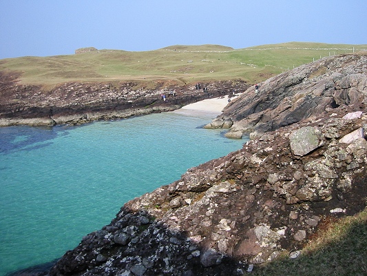
At Clachtoll, 8 km NW of Lochinver, an irregular ancient land surface formed on Lewisian gneisses is covered by red-brown sandstones of the lower part of the Torridonian succession.

![]() Inlet south of Clachtoll, where red-brown conglomerate and
sandstone lie on an irregular surface of Lewisian gneiss.
In the foreground is a conglomerate made of gneiss
boulders, filling a valley in the old surface. On the
right, in the middle distance, is the top of a gneiss
"hill", sticking up through the conglomerate. Draped over
the top of the "hill" are the red sandstones seen on the
left-hand side of the inlet in the background.
Inlet south of Clachtoll, where red-brown conglomerate and
sandstone lie on an irregular surface of Lewisian gneiss.
In the foreground is a conglomerate made of gneiss
boulders, filling a valley in the old surface. On the
right, in the middle distance, is the top of a gneiss
"hill", sticking up through the conglomerate. Draped over
the top of the "hill" are the red sandstones seen on the
left-hand side of the inlet in the background.

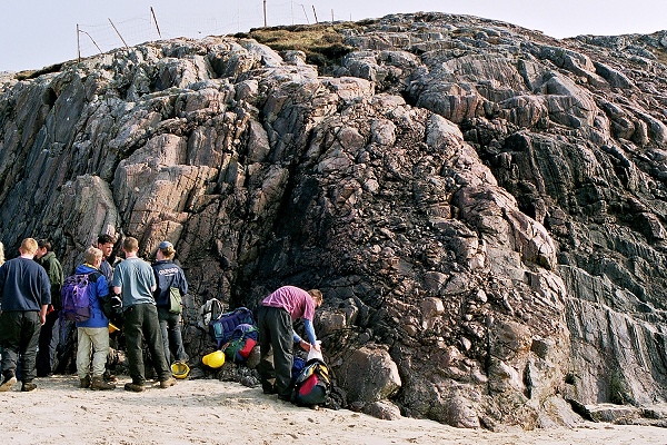
![]() A thin layer of rubble, centre right, lies on the surface
of the gneiss. For some distance around this spot, erosion
has stripped off almost all the Stoer Group sediments,
revealing in detail the shape of the 1200 million-year-old
land surface they were deposited on.
A thin layer of rubble, centre right, lies on the surface
of the gneiss. For some distance around this spot, erosion
has stripped off almost all the Stoer Group sediments,
revealing in detail the shape of the 1200 million-year-old
land surface they were deposited on.
|
Conglomerate, Torridonian (Stoer Group) with large angular clasts of gneiss Clachtoll |
Thin section None for this sample |
|
Coarse feldspathic sandstone (arkose), Torridonian Clachtoll |
| Scourie | Achmelvich | Laxford | Clachtoll | Stoer | Assynt | Skiag Bridge | Glencoul | Knockan | Borralan | Ledmore |
| Home | Geological History | Stratigraphy | Area map | Rock Index | About |
D.J. Waters, Department of Earth Sciences, May 2003