| Home | Geological History | Stratigraphy | Area map | Rock Index | About |

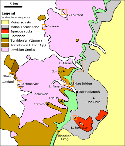
Simplified geological map of the area between Loch Laxford and the Inverpolly Nature Reserve: click on the hot-spots to see the geological relationships and rock types at each locality.

Highly schematic vertical east-west cross-section through the rocks of the Assynt region, not to scale: click on the hot-spots to see the geological relationships and rock types at each locality, or use the menu bar below.
| Scourie | Achmelvich | Laxford | Clachtoll | Stoer | Assynt | Skiag Bridge | Glencoul | Knockan | Borralan | Ledmore |
| Home | Geological History | Stratigraphy | Area map | Rock Index | About |
D.J. Waters, Department of Earth Sciences, May 2003